Trekking the Continental Divide Trail
From High Deserts to Alpine Lakes
Montana and Wyoming
Photography by Amy Grisak and contributed by the Continental Divide Trail Coalition

On a beautiful, warm morning in early June, a group of friends joined me in hiking part of the Continental Divide Trail (CDT) beginning on the north side of Rogers Pass along Highway 200 in Montana. We were in search of chocolate lilies and beautiful views, yet we could have walked all the way to Canada. This simple outing reminded me that our day hike was a mere sampling of the monumental CDT, the longest route of the “Triple Crown,” and how fortunate we are in Montana and Wyoming to hold more than a third of the entire trail.
Stretching from Silver City, New Mexico to either Goat Haunt Ranger Station at the southern end of Waterton Lake, or the Chief Mountain border crossing, the CDT extends 3,100 miles and ranges from 4,200 feet in elevation at Goat Haunt to 14,270 feet at Gray’s Peak in Colorado.
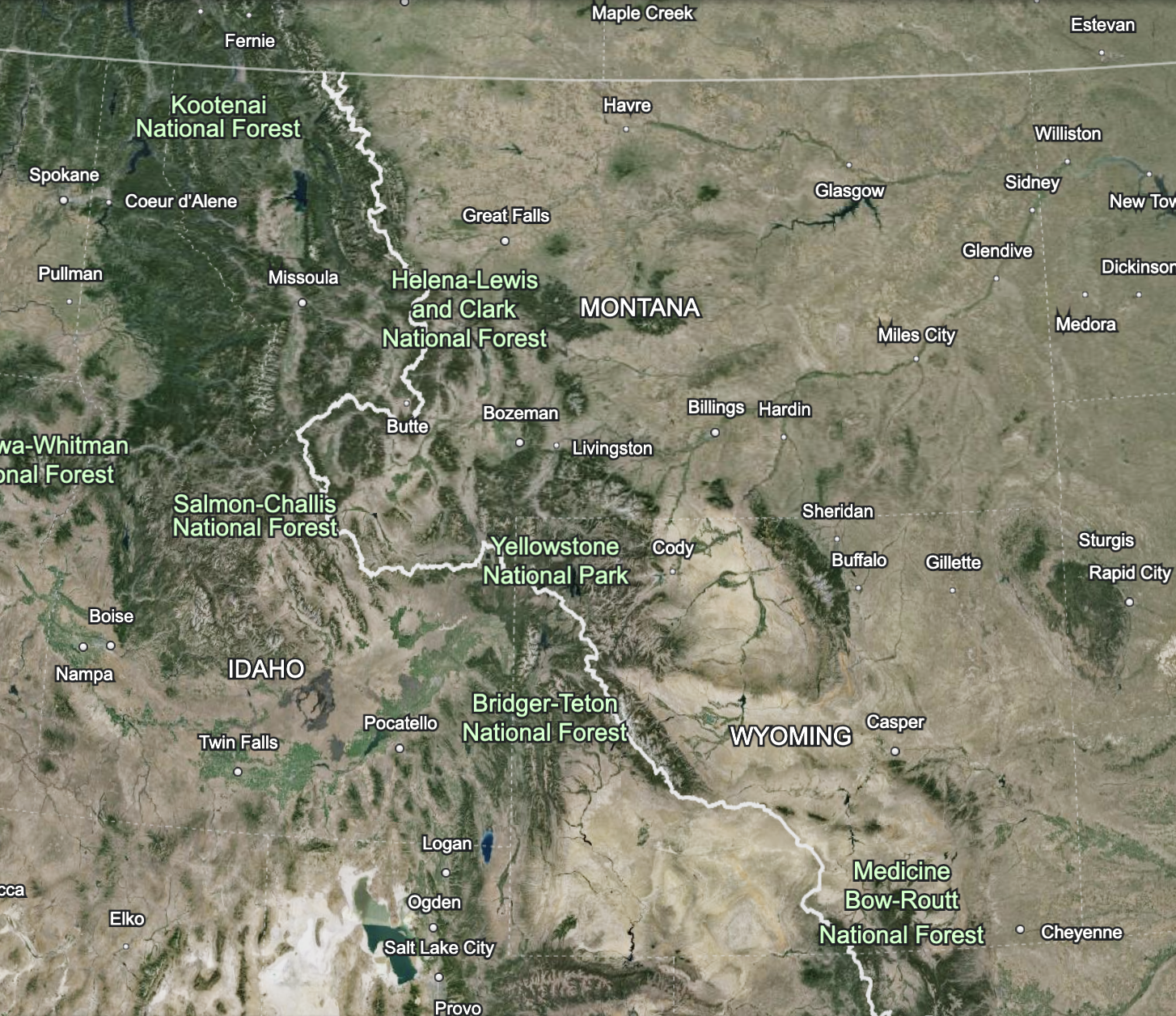
With 550 miles cutting through Wyoming and approximately 800 miles in Montana (plus an additional 180 miles dipping into Idaho along Montana’s western border), hikers experience high desert terrain, deep valleys, towering peaks, the largest thermal area in the world, and, of course, plenty of wildflowers.
Traveling the CDT through this section is a unique experience in and of itself because Wyoming has the most diverse landscape of the five states it reaches.
“One could break up the trail in Wyoming in three parts,” explains Danny Knoll, a board member of the Continental Divide Trail Coalition who has hiked the trail. “It’s nice to have a different landscape every few weeks. It was one of my favorite states. There is a lot of history and indigenous history.”
“At the Colorado border it exits the forest,” he notes. The first small towns along the CDT in Wyoming are Encampment and Riverside. They are situated near the Medicine Bow National Forest at the base of the Sierra Madre Mountains. Encampment grew from the 1838 fur trading post dubbed the “Grand Encampment,” yet it was copper that eventually put the towns on the map.
One unusual aspect of the trail in Wyoming is it goes from forest to desert in seemingly one stride. “It becomes treeless,” says Danny, as the trail leads to the Great Divide Basin, named as such because it resides within a split of the Continental Divide; water does not leave the area, but soaks into the parched earth.
Encompassing roughly 3,900 square miles and sitting at an elevation of 6,500 feet, this is harsh country where a mere 10 inches of rainfall reaches the ground throughout the year. This section of the trail goes on for 120 miles and is a challenging leg of the journey due to the lack of water. Hikers need to carry more than usual, as water sources are few and far between, and experts recommend that those traversing this section fill up at every water source.
Rawlins is located along the southeastern edge of the Great Divide Basin, and is a good place to take a zero (or a rest day, as it’s known to hikers) and resupply. The Great Divide Basin is mostly road walking, which could be good for overused knees on the dramatic climbs in the Colorado section, but can be physically and mentally difficult because of the extreme exposure. You can hike for tens of miles without seeing a tree, and during the heat of the day, the higher elevation and inability to sit, even for a moment, in the shade is difficult.
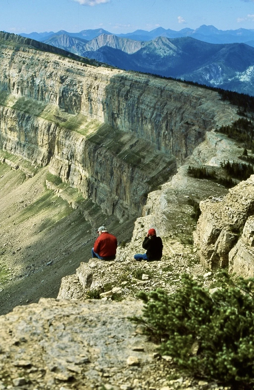
Just as suddenly as the desert opens to hikers along the Wyoming section, it becomes a beautiful forest once again. "From there you get into the Wind River Range,” says Danny. “There are sheer walls of granite cliffs and pristine alpine lakes. It's a stark contrast from the Great Divide Basin.”
The Wind River Range is a favorite among many CDT hikers because of its dramatic landscape, holding seven of the ten largest glaciers in the Lower 48. It’s also important to note that anywhere north of the Great Divide Basin grizzlies are also part of the experience, requiring a heightened awareness in this section.
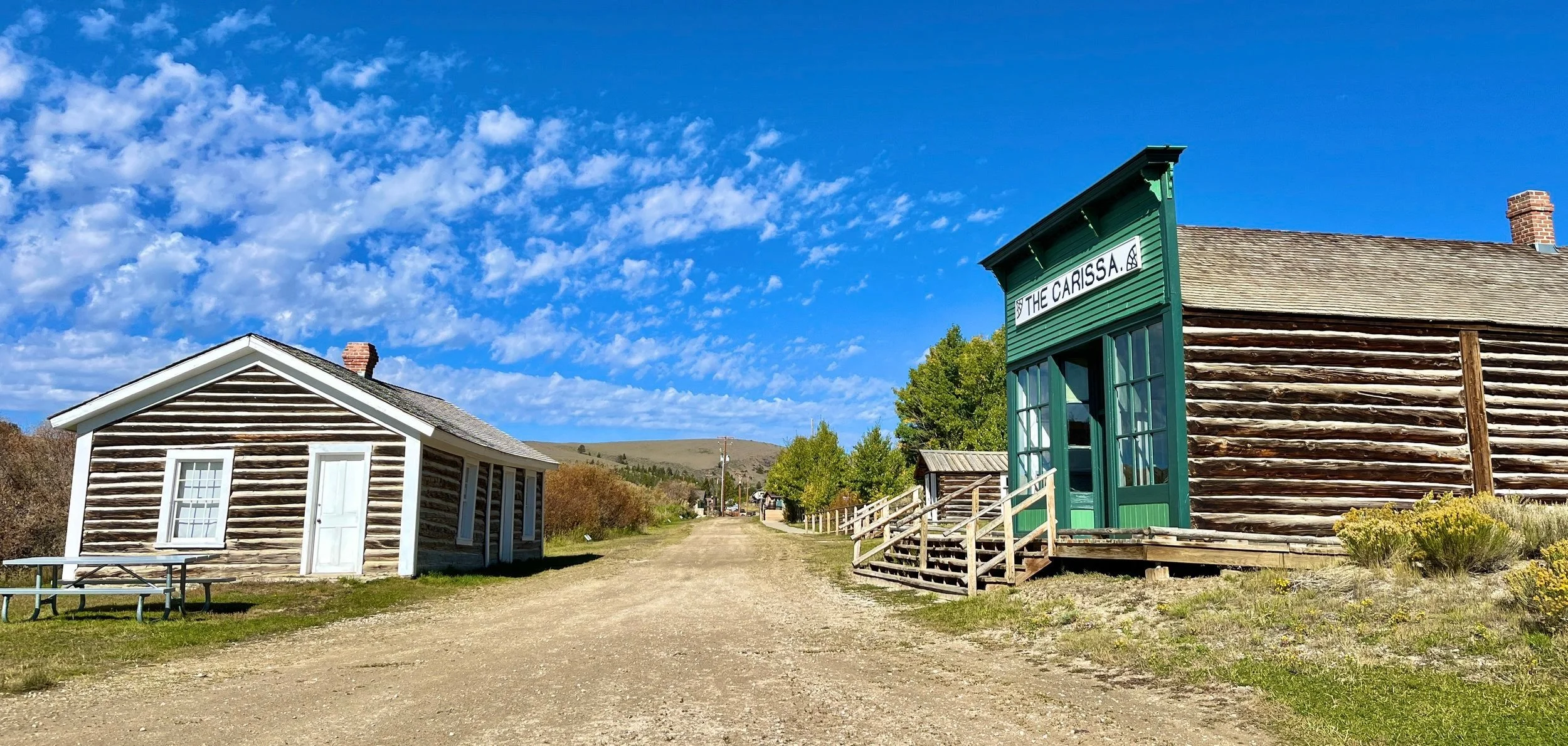
Towards the central region of Wyoming, South Pass City is a popular stop. “There is a lot of historical significance in the area,” says Danny. “It’s where the Oregon and the Mormon Trail passed through.”
Once a thriving gold mining town, there are 17 restored buildings remaining to tell future generations their tale of the rugged life in the Old West. Nearby, Lander is a gateway community (in conjunction with South Pass City) with the necessary amenities to recharge and resupply.
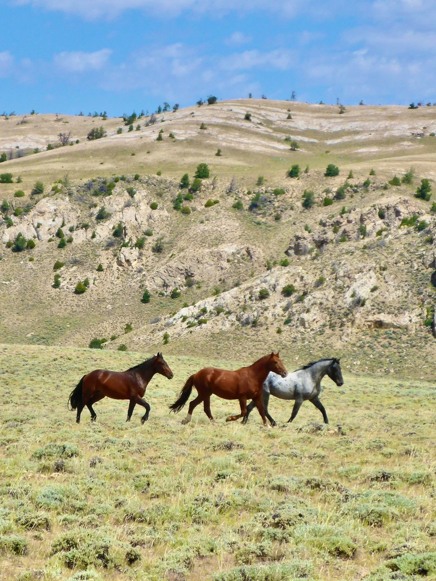
Pinedale is also situated within the Wind River Range and has a long history beginning with the fur trade and eventually progressing to cattle ranching. It’s noted that this area has more wildlife than people, so don’t be surprised to see moose in town or antelope along the trail.
“The Wind River Range is kind of a jaw dropping, dramatic landscape. It may catch people off guard,” says Danny.
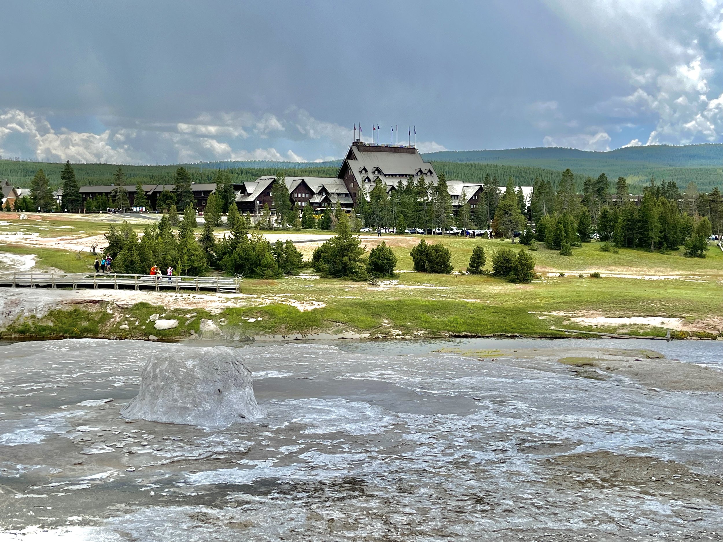
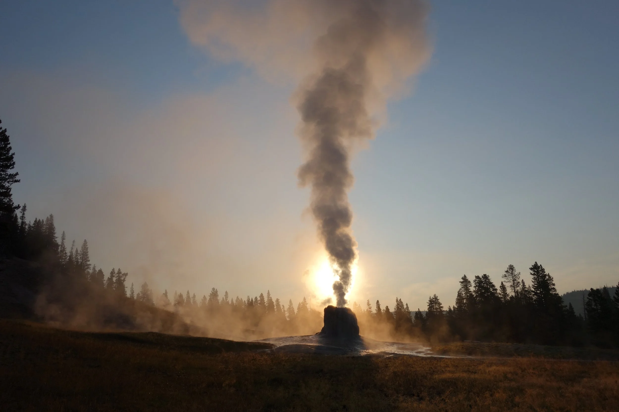
"The last section of Wyoming is through Yellowstone National Park. It goes through the southwest corner of the park,” he notes. “You go through Old Faithful and some of the thermal basins. At times you're walking on the boardwalk.”
L. Fisher, the Director of Trail Programs for the Continental Divide Trail Coalition says, “The CDTC is continuing to work with Yellowstone National Park to increase interpretation, signage, and awareness of the CDT through the park – it passes right by Old Faithful and you'd never know!” The CDTC also hosts annual volunteer projects in the park during the late summer each year.
“The trail exits Wyoming on the western border where Montana, Wyoming, and Idaho come together,” says Danny.
Spanning approximately 180 miles in Idaho, the trail returns to Montana and continues through the Deer Lodge National Forest towards Anaconda and Butte, then east of Deer Lodge until it heads north. From MacDonald Pass, it is approximately 73 miles to reach Rogers Pass where there is a lovely, newer parking area and vault toilet.
To continue on the section we ventured upon, hikers walk across the road and up the handful of steps along the bank to continue this next section that travels across the Scapegoat Wilderness to Benchmark, which is one of the busiest access points to the Bob Marshall Wilderness. Through “The Bob,” hikers walk along the iconic Chinese Wall, a 1000-foot high limestone escarpment that stretches 12 miles long, eventually reaching Maria’s Pass along Highway 2.
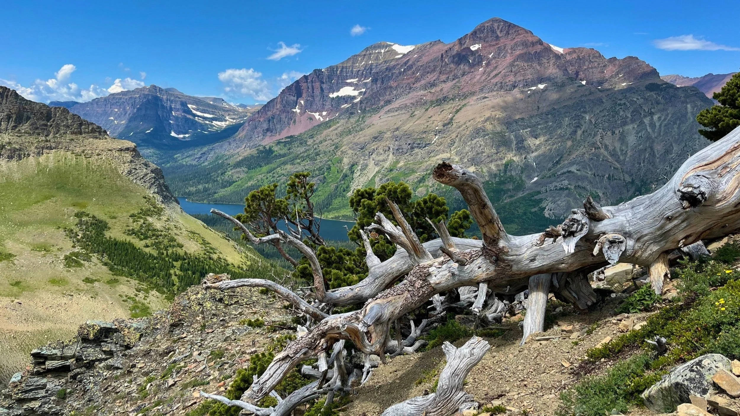
The final section within Montana is the trek across Glacier National Park heading to East Glacier. This section follows the historic horseback route where travelers disembarked from the train at Middle (what is now East Glacier) and rode to Scenic Point before dropping into the Two Medicine Valley. Next, travelers will arrive at St. Mary before climbing Piegan Pass to go to Many Glacier, then trek over Swiftcurrent Pass to head towards the Belly River area. With Chief Mountain in their sight, hikers can opt to continue towards the Chief Mountain Border crossing or diverge to Goat Haunt, which requires either hiking the 12 miles along Waterton Lake or catching a boat ride to the town of Waterton, Alberta. Either way, it’s an epic ending.
The Continental Divide Trail as a whole, or even hiked in sections throughout Montana, Idaho, and Wyoming, is not one for the faint of heart; yet the rewards for this valiant effort are priceless, with scenery that can never adequately be captured in a photo – along with miles upon miles of wildflowers.